ISRO’s CARTOSAT-3 images show damages caused by earthquake in Myanmar
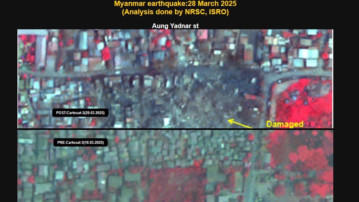
ISRO has released images captured by its earth imaging and mapping satellite, CARTOSAT-3 showcasing the damages caused by the earthquake in Myanmar on March 28. The post-disaster Cartosat-3 imagery was acquired by ISRO on March 29 over the cities of Mandalay and Sagaing in Myanmar, it said. Additionally, the pre-event Cartosat-3 data acquired on March … Read more